Geophysical measurements yield data of layer thicknesses of aquifers and of the their boundaries. Depth and location of
groundwater can be determined.
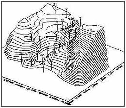
Resistivity sounding
Morphology of a layer boundary gravel-clay within an area of several square kilometers,
a revealed from resistivity depth sounding. The 3D-block diagram
shows a pronounced channel system.
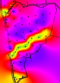
Geoelectric localization of a sand channel (green-yellow for high resistivities) within clays. Layer modeling further
determined the 3-dimensional geometry.
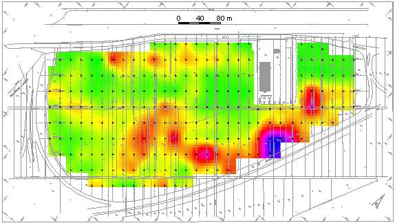
Former
meander channel filled up with fine sediments. 212 resistivity depth soundings.
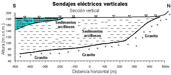
Prospection of ground water in Chile with resistivity depth soundings.