|
-Geophysics
- what for?
-Residual
waste investigation
-Archeological
prospecting
-Construction
sites
-Ex-waste disposals
-Hydrogeology
-Unexploded ordnance
-Exploration of minerals
-Vibration monitoring
-List of services
|
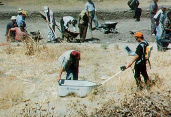
Archeology
Geophysics is used to give evidence of the existance of archaeological sites. Even large areas can be explored quickly.
With geomagnetical, geoelectrical and ground penetrating radar measurements, archaeological structures can be explored
from the surface in a non-destructive way.
|

Resistivity mapping, Panama
|

Magnetometry |
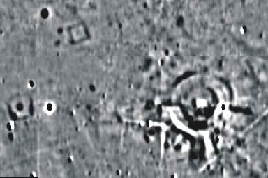
Celtic
grave (width of image ca.70m)
|
Magnetics is the standard method for geophysical prospecting in archaeology. It enables a fast overview of present
structures, as e.g. remnants of old walls. For specific tasks, geoelectrics and ground penetrating radar are at
one´s disposal.
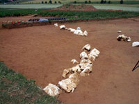
Excavated anomaly: stone ring
|
|

Example:
Geoelectrical mapping of roman remnants.
|
Remnants of walls are often better detected by geoelectrics.
|
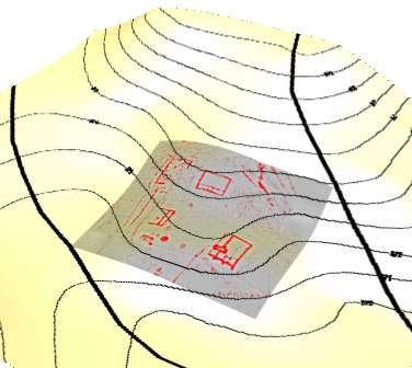
Data can
be visualized in 3 dimensions on top of the topography allowing a better
interpretation.
|
Example:
Roman wall remnants. |
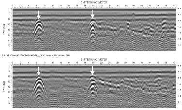
Special
targets can be resolved with georadar, allowing the depth to be determined.
Radar survey in Troy |
 |
Example:
Georadar across a celtic grave hill.
|